|
|||||||||||||
|
|
|
|
|
|
|
|
|
|
|
|
|
|
|
|
|
|
|
|
|
|
|
|
|
|
|
|
|
Background |
|
|
|
|
2010 Spring News Summary & Selected Media Reports
~~~~~~~~~~~~~~~~~~
The redevelopment of Downtown Wichita has hit a few snags -- some possibly disastrous for the original plans -- but signs of sucess and improvements are appearing. Meanwhile, the city's consultants continue developing a comprehensive downtown plan, and have released their basic vision for it (see
SPECIAL REPORT).
The out-of-state developers who charmed the City Council with notions of great downtown developments,
Real Development (popularly nicknamed "The Minnesota Guys")
Passenger rail service is being discussed, as well (see the May 19 item below).
Here's the latest,
in reverse chronological order:
TABLE of CONTENTS:
Mid-April:
Broadview Hotel closes for Renovation
Apr.6:
Downtown Biz Real-Estate in Demand
Mar.22:
NBC's 'Today Show' says Wichita #1 cheap city
Mar.20:
Committee OK's Downtown 'Streetscape' Plans.
Mar.10:
Old Town Cinema district Tax Appeal Goof
Signals weakness in TIF financing of downtown development.
Mar.10:
City cuts loans to Minnesota Guys --
Coming May 19, Wed. eve.
For those interested in passenger rail service for Wichita,
The Amtrak Passenger Rail Study will be explained, and its formal proposals
Visitors can review information provided on four alternatives
for passenger rail expansion presented in the Amtrak study. The information will include potential
travel timetables, estimated ridership, connections to other cities, and operating and infrastructure
costs.
The event is open to anyone who wants to drop in anytime this Wednesday evening (May 19), between 5:00 p.m. and 7:00 p.m., at the
Sedgwick County Extension Office in northwest Wichita, 7001 West 21st Street N. (21st & Ridge
Rd., southeast corner).
If bringing passenger rail service to Wichita is an issue for you, be sure to
attend and speak your mind, and ask tough questions. This is a rare moment where the ordinary
public may have some influence on ultimate decisions about this expensive, significant issue -- and its
a rare opportunity to get answers to serious questions from those who (should) know.
Background information is available online at:
MAP: (current) "AMTRAK Long-Distance Western Routes"
"Legislation on expanded passenger rail service in Kansas advances in House"
Fact Sheet (PDF format):
"Amtrak study proposes four different alternatives
for rail service from Kansas City to Fort Worth"
Supporting views & critique:
Opposing view:
Official AMTRAK Website
The city's main downtown consultant, east-coast-based Goody Clancy, has released their
basic recommendations for a comprehensive downtown redevelopment plan
. Wednesday evening, April 28th, at a public presentation in the Scottish Rite Temple, downtown, the Goody Clancy team presented its "draft vision and beginning framework for the downtown plan."
The report recommended subdividing the downtown redevelopment plan into specific plans for specific geographic subsections of Downtown Wichita, focusing on regions identified as...:
Goody Clancy consultants -- working jointly for the City of Wichita and the
Among the consultants' emphasis was their notion of "multi-modal" transportation: a "balanced" use of not only automobiles for transportation, but also walking, bicycling, public transit, and long-range land travel (bus and train) in downtown.
They recommended parking garages to replace parking lots ("to free up space for downtown development"), but also enhanced walkways, cycle paths, and improved bus service.
Citing superior mass-transit as critical to successful downtown developments nationwide,
One of the consultants hinted at a possibility for connecting new passenger-rail
service with cross-country Greyhound Bus routes,
by bringing them together at Wichita's historic Union Station, just east of Downtown.
DEVELOPMENT COSTS -- WHO PAYS?:
Consultant Sarah Woodworth -- who also is in the business of arranging public/private funding for downtown developments -- stated that financiers require a minimum of an 8.5% ROI (annual Return on Investment) to be willing to back a development.
She
hinted that the inherent economics of proposed development projects would likely be multiple percentage points below that, requiring partial public funding (or funding guarantees) equal to an annual city contribution of 1%-4% of the total project costs -- each year, indefinitely -- if private financiers were to be effectively attracted to underwriting Wichita's downtown development projects.
For instance, a 10-million-dollar development project could require a $100,000 a year subsidy from the city, for the life of the financier's loan. With several hundreds of millions in downtown development proposed by the consultants, that may tap the City coffers to the tune of millions of dollars every year, for decades, to support this one-time investment in downtown revitalization.
(And that is to say nothing of the continuing costs of the proposed radically expanded transit service, nor the cost of operation and maintenance for the proposed new parking garages, streets, sidewalks, signals, signs, lights, trees, decor and other public amenities.)
To raise the construction money, the consultants, developers and others have proposed sales tax* hikes -- as done to fund the construction of the Intrust Bank Arena -- as a way to underwrite and fund the proposed downtown developments, and guarantee financiers an acceptable rate of return on their Downtown investments.
During a public question-and-answer break, this author asked about what the city's return on the massive investment would be from the proposed developments -- and whether the consultant's had any hard numbers on THAT. The Goody Clancy consultants (including head consultant David Dixon) admitted to the audience that they had not gathered any such numbers -- and that they were, indeed, crucial and needed for evaluating the plan, and making decisions on whether to go forward with it (particularly on specific projects and financing decisions).
RESIDENTIAL COSTS:
Others expressed curiosity and concern about the affordability of the 1,000 additional residences that Goody Clancy consultants say the city needs to integate into the downtown plan, over the next several years.
Dixon also defended a previous position, announced at Goody Clancy's Feb.28th "public-input charette," suggesting that Wichitans need to think about spending more years' salary on their home, and that downtown residences need to be developed and priced accordingly.
This author, questioning Dixon publicly on the consultant's proposed price of downtown housing, expressed concern that national economists are saying America has long over-spent on housing (the problem underlying the recent national economic catastrophe), making greater spending on housing contrary to the long-term trend change prescribed for the nation by most economists.
Dixon acknowledge the concern, and noted that developing downtown housing costs more than building in "green fields," a factor reflected in its pricing. But Dixon said it was important to evaluate housing costs in terms of more than simply the price of the residence.
"Transportation is a key factor in the cost of housing," said Dixon, adding "that cost is affected by rapidly rising energy prices."
Dixon noted that "some very good national studies" show that downtown living -- in pleasant and accommodating surroundings, with necessary shopping and dining in walking distance,
Dixon said that the benefit from that savings could help homebuyers fund the higher cost of acquiring new downtown residences.
ALREADY A DONE DEAL?
Mayor Carl Brewer, speaking at the meeting, however, seemed rather dismissive of concerns expressed -- noting that the City's downtown-redevelopment planning process had "already generated a lot of excitement", and as a consequence "we already have a lot" of downtown developments underway.
Indeed, to a large extent, the announcement of Goody Clancy's detailed plan was rather anti-climactic, since most of the major factors of downtown redevelopment are already in place, settled, underway or being negotiated in advance of the city's formal development plan (click on last map at far right) --
Some examples of developments previously undertaken, or initiated have already included:
and
Wichita Eagle, April 29, 2010
For a look at the official report
(in Adobe Acrobat PDF format),
click here:
"Downtown Wichita Streetscape Design Guidelines - Final Draft"
The Minnesota Guys now own 9 office buildings in downtown, and some are facing problems:
Downtown is important to ALL of us in Wichita. Each of us either works, plays, shops, eats, attends church or civic events, uses government services, visits libraries, explores museums, or enjoys entertainments, in Downtown -- and in the adjacent (and affected) Old Town and Delano districts.
And we ALL pay the taxes that support downtown government operations, and the arena -- and the development and maintenance of streets and highways into Downtown Wichita.
Downtown Wichita is
Downtown's Future is OUR Future.
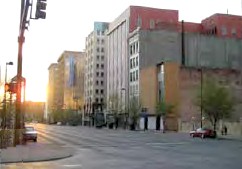 have apparently begun disappointing folks. Some of their developments failed to meet criteria for planned financing, funding cashflow demands overwhelmed their operations, and they have asked the city for more tax money -- getting a tentative "no" from wary Council members, once enthusiastic supporters (with some of their campaigns largely funded by the Minnesota Guys).
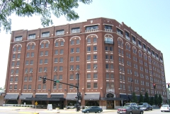 Other developers are moving ahead on their own, with renovations, at sites ranging from the Broadview Hotel to the Commerce Street Arts District.
(Click on the date, to jump down to the story)
Coming May 19:
PUBLIC MEETING:
Passenger Rail Service Meeting
City Downtown Redevelopment Master Plan - Basics Released
Public Open House Event
 Apr.13:
Exchange Place developer "Minnesota Guys" seek $2m more from City Taxes;
City Council Balks
 Apr.8:
Farha Builds Condo-Apartments with Shops
in Commerce St. Arts District Finn Bldg.
 Apr.6:
New residents may help revive downtown
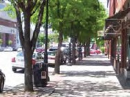
Wichita Executive Center, Sutton Place, Broadway Plaza at stake.
 Mar.9:
Commerce Plaza sale bombs
 Mar.2:
City Bills $2.7 million in Parking Tickets -- mostly Downtown.
DETAILS:
Passenger Rail Service Meeting

Public Open House Event
 Wednesday
evening, May 19 in Wichita, the Kansas Dept. of Transportation (KDOT) is holding a public "open house" to describe various plans under consideration. The public is
invited, and KDOT people will be there to answer questions and discuss issues.
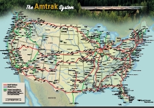 will be detailed in
presentations at 5:20pm and 6:20 pm.
"Passenger Rail Study Meeting Set For Wichita"
May 5, 2010
KWCH-TV
(apparently from an AMTRAK brochure)
March 10, 2010
Associated Press, published in "Canadian Business"
posted 03/10/2010 on freerepublic.org
"Feasibility Study of Expanded Passenger Rail Service in Kansas"
March 11, 2010
prepared by Amtrak & BNSF Railway
for the Ks. Dept. of Transportation
March 31, 2010
Oklahoma Gazette
"Support for train at a critical mass"
by former Lt. Gov. Shelby Smith
...and...
"Keep train on same schedule"
by James A. McClellan
Feb 12, 2010
Wichita Eagle
"Kansas makes unwise bet on passenger rail"
by Bob Weeks, on libertarian website WichitaLiberty.org
with current routes, schedules, fares
and other consumer info, including
National Route Map
(PDF: 2.5mb)
City Downtown Redevelopment Master Plan - Basics Released
 Wichita Downtown Development Corp. -- provided a lengthy list of detail suggestions for improvements in each area. Emphasis was on improving streetscapes and transit, using existing historic structures, developing medium- to high-cost apartments/condominiums, and supporting the development with tax money or city bonds.
 TRANSPORTATION - EVERY WAY:
 the consultants urged a vast expansion of the current "Q-line" shuttle bus throughout most of downtown, radically extending service to "7 days a week, 18 hours a day," and multiple simultaneous loops running continuously throughout downtown.
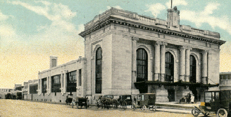 (Currently, Union Station is being vacated by Cox Communications; the Greyhound bus terminal is on Broadway, in south-central Downtown.)


* Critics note that a sales tax is regressive, creating the greatest hardship for those who can least afford it -- shifting the suffering from the rich to the poor and working class.
 Dixon tried to reassure his audience that there would be low-cost housing integrated with the very high-priced condos currently being proposed by downtown's chief developer, Minnesota-based "Real Development."

 and good public transit handy -- results in an "average reduction of $8,000 annually in household costs."
For additional info, see:

 (Real Development -- who heavily the funded campaigns of victorious Wichita City Council candidates)
to acquire 9 key/major Wichita downtown buildings
-- including nearly a block of major buildings on Douglas in the heart of downtown.
 -- Wichita's historic Union Station and the huge Spaghetti Warehouse -- have reportedly been sold to California/Kansas entrepreneur, Jackson Hill III, for use as a movie studio. Hill does not seem interested in making these properties open to public activity -- making them obstacles (rather than assets) to a seamless connection of Old Town and Downtown. This stands in stark contrast to repeated remarks by the consultants suggesting Union Station as a public railroad station for future passenger train service, with other amenities supporting downtown living.
 "Commerce Street Arts District" and begun his own development
of them. (Fortunately for the city consultant's plan, Farha's developments match their ideas.)
Wichita Business Journal, April 29, 2010:
"Goody Clancy rolls out vision statement",
"Downtown, diversified: Consultants envision variety of niche districts",
also posted on Wichita Downtown Development Corp. website, as:
"Downtown Diversified: Development",
City Council Balks at Favorite Developer's Request for Millions More in Tax Money.
The City Council has initially refused a request from their main downtown developer,
the out-of-state
"Minnesota Guys" ("Real Development"), who have asked for another $2 million in tax increment financing (TIF) money for their $51 million development of Exchange Place,
on top of the $8 million they already received without argument.
 Exchange Place
is a planned redevelopment of the parking garage and neighboring buildings, on the
north side of Douglas, between the historic Kress Store at Broadway and the old 4th Nat'l Bank / Litwin Bldg. at Market.
The plans call for a batch of expensive apartments (planned to sell later as condominiums), with an exotic elevator/robotic parking garage, and rooftop park and swimming pool. Ground floor shopping is also planned.
Goody Clancy,
the city's main consultants on downtown redevelopment say that "cheap" condos ($100,000-$250,000) are key to drawing young professionals to live in downtown (a key objective of downtown revitialization),
though they express some reluctance to vouch for the economics of the current Exchange Place plan.
(See Wichita Eagle,
April 14, 2010
"Denial may force out developers, city told",
and
April 13, 2010:
"Decision on more money for downtown development is on hold",
and
April 12, 2010:
"Downtown Wichita developers likely to get less aid than they sought",
and
"Future of major downtown development is a moving target".)
Broadview Hotel closes for Renovation:
 The Broadview Hotel
, Wichita's historic downtown anchor hotel
(at Douglas and Waco, across from Century II, on the bank of the river),
will be closed for 10 months, for another renovation.
(See Wichita Eagle, April 13, 2010:
"Broadview: Old and New".)

"Finn Lofts to include businesses", the Wichita
Eagle reports, noting this and similar developments in the
Commerce St. Arts District, south of the Arena.
Local developer David Farha is designing his
renovation of old warehouses and industrial buildings into mixed-use structures, with business activity on the ground floor and living quarters above. David Dixon, of city downtown-revitalization consultant Goody Clancy, says it fits perfectly with the consultant's vision for downtown Wichita.
![]()
"Business real estate downtown in demand", the Wichita Eagle reports, citing downtown real-estate brokers who say
downtown office space demand is up, unexpectedly soon, despite a down economy. Some brokers are in a buying mood, though local loan money is tight.
Arena completion has helped boost interest in downtown property, too.
"Residents helping revive downtown", the Wichita Eagle quotes
Goody Clancy consultant David Dixon, saying the current 1,000 housing units
 in downtown
could easily double within 7 years,
to accomodate young professionals and middle-aged/elderly "empty-nesters," if downtown is made more attractive. Dixon says the coming generation of young pro's want to live and work in old buildings, in pleasant, thriving downtown environments. Dixon's employer, East-coast based Goody Clancy, is the city's main consultant for the master plan for downtown redevelopment.
"'Today Show' names Wichita #1 Most Affordable City", the Wichita Eagle reports.
NBC-TV's "Today Show"
their nationwide morning news and information program carried on affiliate stations nationwide, ranked Wichita as the "most affordable city" in the nation -- echoing a commonly reported plus for Wichita development. Downtown development consultants have cited this as one of the strongest features of Wichita in the eyes of young professionals, the city's official target market for downtown housing development.

"Committee approves Downtown Streetscape", the Wichita Eagle reports, pointing to
city approval of downtown street/walkway/bikeway plans -- including various amenities and decor -- designed and proposed by Wichita's own Professional Engineering Consultants and Skinner Design Studios.
Main downtown development consultant Goody Clancy will use the design as a basis for its proposals about specific property developments in the area.
"Report: Errors made in Old Town Cinema district tax appeal", the Wichita Eagle says, pointing to
a critical weakness underlying the city's strategy for financing development with TIF (Tax Increment Financing) districts
-- special development zones where the city gambles its money to invest in developing an area on the expectation of future tax revenues from that area.
 The City of Wichita has released a report on
the Old Town tax fiasco involving city property leased by David Burk,
who (some officials suggest) may have misrepresented himself as a agent of city government when appealing his taxes,
persuading county officials to cut him a nearly $50,000 break on his taxes (for 2007 & 2008), at public expense
-- undermining the tax revenues that the city was expecting to get from Burk's development to repay city investment in the property, and the 3-block Warren Old Town Theater/shopping/parking complex.
City Manager Robert Layton hints that it may not be worth pursuing to recover the lost money, and that this could happen again.
"City reduces its loan to developers:
Real Development's work on Sutton Place is on hold, say Wichita officials.", the Wichita Eagle says, noting that
Wichita city government has rescinded a small chunk of the funding it gave "The Minnesota Guys" (Real Development) because of delays and inappropriate use of some of the money.
"Downtown's Commerce Plaza on the market", the Wichita Eagle says,
a deal by "The Minnesota Guys" ("Real Development")
 to buy
Commerce Plaza, a 5-story, 73,000-square-foot office building at 401 E. Douglas (originally the 1932 Montgomery Wards store), has apparently bombed, and the Ruthvens who own it seem content. The building has 60% occupancy (pretty good for downtown Wichita). Asking price is just under $2.4 million.
"Wichita Averages 20,000 Parking Tickets a Year"
 , according to a report by the Wichita Eagle.
The city raised $2.7 million from the fines, mostly collected in downtown,
particularly violators in the area around city hall and the county courthouses, at Central & Main.
Parking complaints (including parking fees & tickets) remain
one of the major sticking points deterring people from going downtown.
the HEART of OUR City!
Get involved, and shape it!
PHOTOS
(click to enlarge)
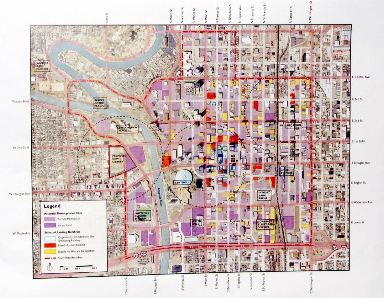
The downtown planning map. Dark purple is vacant land, light purple is parking. Orange-red are officially "historic" buildings, allowing "historic preservation" funds, with regulatory strings. Yellow buildings are eligible for "historic" status. Blue-outlined buildings have "potential" for "additional use."
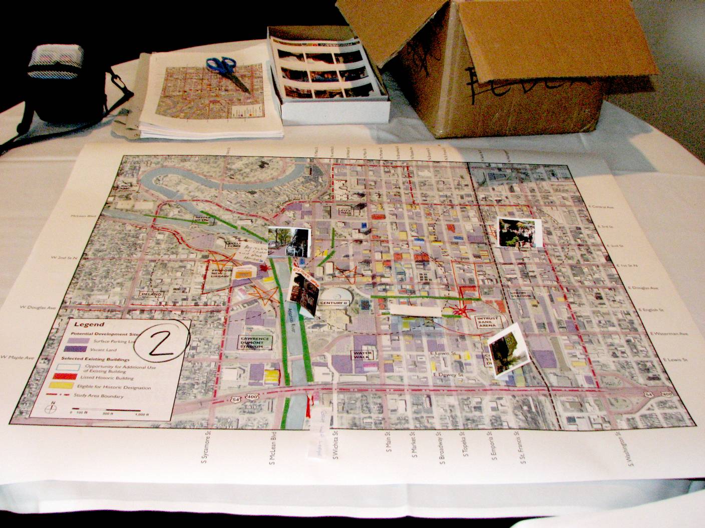
Downtown development map marked up by
Charette
"Group 2" -- showing "green-space" improvements along the river, along with yellow apartment buildings, and a magenta hotel. Blue office buildings sprout along 2nd street, while a south-downtown "transportation hub" area -- with parking, mass transit, bikeways, walkways and streets -- connects Kellogg traffic, Century II, and the Arena area (circled in red to note recommended retail/dining development).
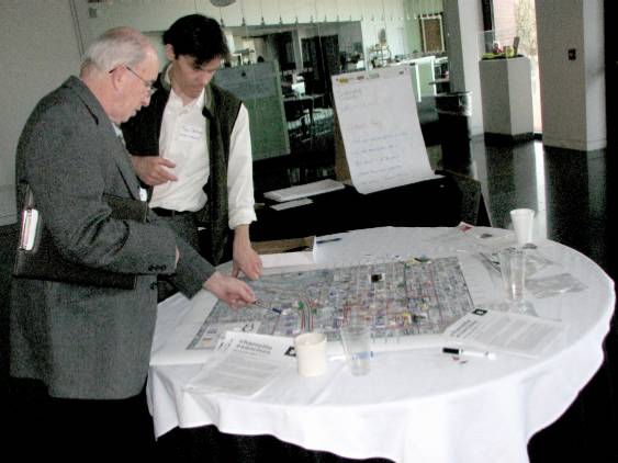
A property owner conferrs with a young Goody Clancy consultant over property in the downtown area, pointing to a map marked up by one of the "citizen" groups at the Feb.28th "charette".
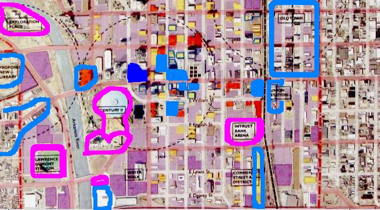
Downtown closeup -- buildings & projects already arranged or completed before consultant's plan released. (Click to enlarge.)
-
RED-ORANGE: Historic buildings (to be preserved).
- MAGENTA: Existing major entertainment venues.
- LIGHT BLUE: Developments already completed, underway, or being arranged.
- DARK BLUE: Existing major business building complex (unlikely to change) (Intrust Bank).
- MAGENTA: Existing major entertainment venues.
|
|
|
|
|
|
|
|
|
|
|
|
|
|
|
|
|
|
|
|
|
|
|
|
|
|
|
|
|
Background |
|
|
|
|